Post by Tim.
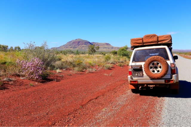
After leaving Port Hedland we headed south along the Great Northern Highway towards Karijini National Park.

After passing through some amazing terrain of natural rock piles and wild flowers we began to climb the Chichester Range and wind our way through to the eastern end of the Hammersley Range.

Approx 250kms down the highway we took the turnoff to the west into Karijini National Park. Karijini National Park is like no other place I have ever been to or seen photos of. There are 7 Gorges in the park and all are very different and unique in there own way.
The Geology of the park is like this - Rocks in and around the gorges originated as fine grain sediment which accumulated on the sea bed some 2.5 Billion years ago. What makes this place so incredible is that the layers of rock dramatically vary in colour so much that the walls of the gorges almost look painted.
Over the millions of years water has sculptured the rock leaving deep chasms with permanent flowing water, plunge pools and water falls. Inside the gorges you need to literally climb along the walls of the chasms, and swim and walk through very very cold water in order to reach the most stunning points. Most of the gorges have a point where you can't continue without absailing gear or jumping off the waterfalls and hoping for the best.
Although I never walk away from a challenge, I am probably the first to admit I wasn't properly prepared for Karijini considering I had to carry a lot of expensive camera gear with me and also consider safety. Perhaps a water proof and shock proof camer case would have made life easier and allowed me to keep my hands free to climb with.

The first gorge (Dales Gorge) was tame compared to the rest and didn't throw up too many issues. Dales Gorge (in my opinion) is the least unique of the gorges but still worth a look.
Entering the top end of the Gorge you descend down the rock and provided ladders to Fortescue Falls.


The incredible layers of rock begin to appear almost immediately as you begin your decent.


From the falls you then walk down the gorge for around 600m following the river which cascades through many pools.

You then via to the left and head up a side gorge. Approx 300m along you reach the end of the gorge and 'Circular Pool'. This is probably the highlight of the walk and is accessible via the bottom end of the walk which is only a few hundred metres from the day use area and a further few hundred metres from the camping area. It consists of a crystal clear plunge pool with spring fed water cascades flowing through a fern garden. The water was the coldest of any gorge so far on our entire trip and due to the air temperature also being pretty crisp we passed on this one.

Approx 50kms to the west is the best part of the park as all of the stunning places are all within a few km's of each other.
Oxer lookout and Junction Pool lookout sit at a point where 5 gorges all meet to for one. It's here where to can climb into Waeno and Hancock Gorges.

The first gorge we tackled was Weano.
You can access the narrow part of the gorge via a ladder beside the car park but we decided to do the extended walk which was a loop to the top of the gorge and then follow the river back down to the other end.

As the gorge slowly got steeper and narrower we reached a narrow section which then plunged into a deep pool called 'Hand Rail Pool'. In the photo below you can see the hand rail that's required to scale down and around the pool. Unfortunately I didn't get a photo of the pool or many of the other sections of the chasm as I was too busy trying to climb or swim through the pools. At the other end of Hand Rail Pool there is a narrow section where I had to walk through with my camera, tripod and bag held above my head. The water was up to the bottom of my chin at one point and it was freezing cold.

Once through the deep section the chasm gets shallower with the water flowing freely again. About 50m further along we reached the top of a waterfall that plunged into another pool. This is pretty much the end of the line unless you have absailing gear and want to continue through to the main gorge (Red Gorge) and somehow get out.
I left the camera with Kristy and followed some other guys who walked along a narrow ledge for about another 50m but then turned around.

The two photos below are a couple of sections you walk through before getting to Handrail Pool. The rocks are really slippery most of the time. I was already imagining what was required next time to complete the gorges.


The next day after our boots had dried out we drove back to the car park to attempt 'Hancock Gorge' which is generally considered the most stunning of all of the gorges.
From the top of the gorge we climbed down a ladder and began the walk down the gorge. Almost immediately we had to walk through water and scale around the edges of the gorge on narrow ledges in the rock.

I had a water proof bag for my camera but the rest of the gear was only in my main bag.

Around 150m further along we reached the 'Spider Walk' where we had make our way through a narrow section perched a few metres above the flowing water.

Once through and a further 30m along we reached 'Kermis Pool'. Fortunately I was able to find some spots to set up my tripod as this was my favourite spot in the park.
The layers of red and blue rock lead you into a deep plunge pool which then falls down into another plunge pool and on and on....

The natural colours in this gorge are so amazing with the layers if rock being lit up by reflections of light somehow making its way from the top, and the turquoise coloured water in the pools..... wow!
The photos in this post (and all others) are unedited and transferred straight from my camera to my iPad so the colours you can see is a true representation of what exists. Despite getting heaps of good shots I doubt any photo would ever do this place justice. I also think the photos need to be viewed fairly large to see the detail in the rock so the small size in this post probably isn't sufficient.
The photo below was taken from the same spot as the one above. I simply turned around. At the top of the photo you can see the end of the 'Spider Walk'.

We managed to crawl around a ledge to the other side of 'Kermits Pool' where the water fell away into several other pools. Unfortunately there is a large drop so this was the end of the road (this time).


The bottom of 'Spider Walk' looking towards 'Kermits Pool'

The third and final gorge we would visit in this section of the park was 'Knox Gorge'. This was a similar story with narrow chasms (probably the narrowest) cutting through the rock.

After scaling through we reached the section below which was impassible. Only about 50m along the gorge drops down into 'Red Gorge' which is the gorge formed where the others all meet. We managed to crawl down to a large rock that was wedged between the walls. You can see the sticks backed up behind it. From that rock you look down into the Red Gorge. There is so much more to see next time!!!!


Two more pics below walking back up Knox Gorge.


We camped at the Karijini Eco Resort for 2 nights which was pretty nice. They had solar hot water showers and flushing toilets which was nice change compared to Dales Gorge which we had camped the 2 previous nights, being very basic with only bush toilets.


After leaving the Eco Resort we headed for Millstream National Park via the town of 'Tom Price' for fuel and a quick stop at the final gorge in Karijini 'Hamersley'.
Another stunning drive.


Looking down into Hamersley Gorge. Imagine the forces required to twist the layers of rock like that.

A short 100m walk up the gorge and you come a nice swimming hole and right above it is 'Spa Pool'. Another amazing sculptured rock formation with crystal clear water.

After leaving Karijini for the final time we drove around 150km to 'Millstream National Park'. Along the way we passed by a lot of train lines and private roads used by the many mines in the area.


Millstream was pretty nice but fairly similar to a lot of the county we had already driven through.


We camped near the 'Fortescue River' for one night before continuing north west to the 'Chichester' section of the park.


The drive through the Chichester Range and west towards the highway was one if the most scenic of the trip so far. Tabletop mountains, spinifex grass, and wild flowers made an interesting combination which almost felt like the southern high country at times due to the cool winds.


'Python Pool' at the bottom of the range.


More natural piles of rock. I'm sure there is a great geological explanation for them somewhere.


Not far from here we meet up with the highway and head south towards Point Samson.

No comments:
Post a Comment